>_ Drone Mapping

DII Drone Market Map 2026 Lists 1,413 Companies

The 2026 edition from Drone Industry Insights records firms from 70 countries, up 31 percent since 2022, spanning hardware, software, and services relevant to detection and mitigation systems.

Drone Industry Insights has documented 1,413 companies operating across the drone sector from 70 countries in its 2026 Market Map.

This total marks a 31 percent rise from the 1,076 companies cataloged in the 2022 edition of the same report.

Roughly 300 entities listed in 2022 were removed after mergers, acquisitions, bankruptcies, or exits from the civil drone market.

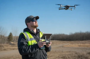
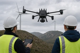
The map details activity in hardware manufacturing, software development, and service provision, providing law enforcement agencies with a clear snapshot of suppliers that produce platforms, flight management tools, and analytics platforms used in surveillance and counter-drone operations.

Agencies responsible for airspace security at prisons, borders, and critical infrastructure can use the data to track emerging sensor technologies and data-processing solutions that support behavioral analysis and real-time tracking.

The Drone Girl reported that the increase reflects sustained investment in both commercial and specialized systems despite industry consolidation.

Drone Industry Insights makes the full map available as a free download on droneii.com beginning in early June 2026.

Dronedesk highlighted the geographic spread across 70 nations and the inclusion of companies that supply components for integrated security platforms.

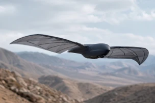
Hardware entries cover airframes, propulsion units, and payloads such as electro-optical and infrared cameras frequently integrated into detection networks.

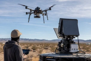
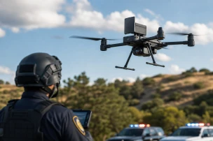
Software listings include flight-planning applications, airspace management platforms, and data-fusion tools that feed into command systems used by highway patrol and sheriff offices.

Service providers listed range from training organizations to maintenance contractors that support fleet operations for public-safety users.

The updated count supplies procurement teams with a verified reference when evaluating vendors for drone mitigation suites that combine radar, radio-frequency sensors, and AI-driven classification.

Overall the market map serves as an essential tool for stakeholders seeking to understand the competitive environment and potential partnerships in the drone industry. It highlights the dynamic nature of the sector with continuous entries and exits shaping future directions for technology adoption.

About the author

Emily Carter
// Written by Emily Carter

She focuses on politics and technology, delivering in-depth analysis of policy developments and their societal impacts. Her journalistic approach emphasizes investigative rigor and balanced perspectives across complex issues. Emily also covers environmental topics, highlighting connections between economic trends and sustainable practices.

>_ You might also be interested

Flyby Guys Recruits Skilled Drone Pilots for Expansion

Flyby Guys Recruits Skilled Drone Pilots for Expansion

Ornithopters Advance Stealth Drone Capabilities for Security

Ornithopters Advance Stealth Drone Capabilities for Security

Niantic Spatial and Spexi Enable City-Scale Physical AI

Niantic Spatial and Spexi Enable City-Scale Physical AI

Red Cat Holdings Acquires Quaze for Drone Wireless Power

Red Cat Holdings Acquires Quaze for Drone Wireless Power

RAF Typhoons Deploy APKWS Rockets for Drone Defense

RAF Typhoons Deploy APKWS Rockets for Drone Defense

Terra Drone, DSLRPros Partner on Terra Xross 1 for US Market

Terra Drone, DSLRPros Partner on Terra Xross 1 for US Market

Drone Manufacturing Growth Fuels Technician Hiring Surge

Drone Manufacturing Growth Fuels Technician Hiring Surge

Colorado Springs Drone Tracks Fleeing Burglary Suspect

Colorado Springs Drone Tracks Fleeing Burglary Suspect

Enovix Korea Posts Drone Battery Technician Role

Enovix Korea Posts Drone Battery Technician Role

Echodyne Axon Partnership Adds Radar to Public Safety Drones

Echodyne Axon Partnership Adds Radar to Public Safety Drones

Comments 0

User
Your profileYour profile
AnonymousAnonymous

Pin this comment?

If you already pinned a comment, this will replace it

Delete Comment

Delete the comment forever?

Delete Answer

Delete the answer forever?

Report Comment

Report Reply

>_ Font Size

Adjust the article text size.

Preview text — Aa
>_ Report


5
×
To do this you must log in

When you join the system, you can enjoy the following benefits:

  • Access to content without advertisements.
  • Option to change the interface language to the language you prefer.
  • Possibility to adjust the size of the text.
  • Opportunity to report inappropriate content or inappropriate advertising.
  • Option to save articles and content you like for later reading.
  • An opportunity to express yourself and comment on the articles you will read.
Login to your account